 +91 9799050299
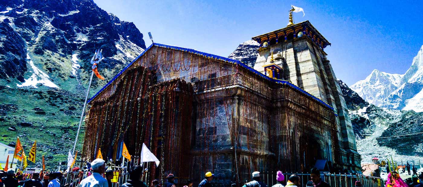
Geography of Kedarnath
Kedarnath spreads over an area of 3 sq km and is surrounded by Kedarnath mountains peak ( 6940 mts )and the Kedarnath Dome ( 6831 mts ). The gorgeous view of majestic mountains peaks of Gangotri I, II & III peaks of the Gangotri Group is the highlights of the region.
The population of Kedarnath is not fixed as people from nearby such as Guptkashi, Ukhimath come here and stay for 6months during the summer. Most of the people staying here are Badrinath Temple priest, merchants, shopkeepers and people who work in hotels and restaurants here.
The people leave Kedarnath during the winters for their villages as it is covered by a snow blanket for nearly 6months during which the idol of Shiva is shifted to its winter residence in Ukhimath.
Hindus form the majority of people in Kedarnath and Hindi and Garhwali and the major languages spoken by the people. Other languages spoken in the region are Kumaoni and English.
Kedarnath has a cold climate so summers are cool and winters colder. Kedarnath is covered with snow during the winter months during the months between November and April. Kedarnath can be visited during the summer months and rainy seasons should be avoided.
The temple of Kedarnath is situated in the district of Rudraprayag and this holy pilgrimage town is the junction centre for the pilgrims making their way from Kedarnath to Badrinath or vice versa. This ancient temple is also placed close to the glacier of Chorabari which forms the head of Mandakini river. The entire trekking route will take you through some hair pin bends and inter winding paved paths which cuts through the mountains. This holy pilgrimage town is situated at a distance of 86 kms from the main town of Rudraprayag. The valley is also surrounded by gently rolling hills with jagged features with the gushing river water of Mandakini making its way through the valley.
