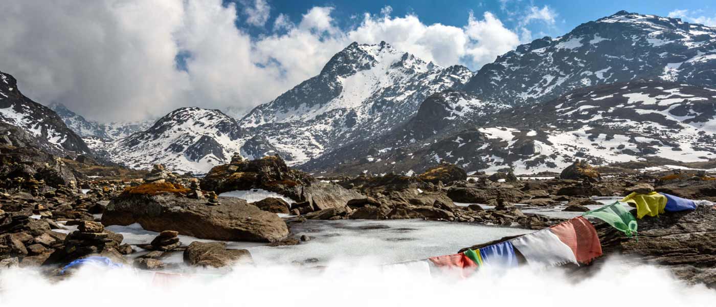
Geography of Nepal,
Nepal is a beautiful Himalayan landlocked country located between China and India. It is spread in the area of 147181 SqKm. On the basis of the geographical structure, Nepal can be divided mainly into three regions: The Himalayan region, the Middle Hill region and the Terai (Plain Land) region. The highest elevation of Nepal is the summit of Mount Everest at 8848m and the lowest elevation is 60m from the sea level at the Terai. The climatic conditions are from subtropical to the freezing.
The Himalayan region covers 16% of the total land area. It is the least populated area due to the cold weather and very less fertile land. People have been moving settlements; winter and summer camp settlement. Sherpa people are the distinct ethnic groups in this region. The area covers all the Himalayan range. The Middle hill region is spread in 65% of the total land. It is also populated, less than half of the population that it is expected because the lifestyle in the hillside are still challenging. Mostly Gurung, Magar, Newar, Brahmin and Chhetri populate this region. It covers forests, terraced fields and the conservation areas. This region is popular for preserving the endangered species like red panda, leopard, bear and several species of birds. The Terai region is covered by plain lands and dense forests. It covers 17% of the total land, which includes almost industries. It has wildlife reserves and sub-tropical forests. Terai is the most populated region in Nepal.
Nepal is such a country that every kind of climate and diverse flora and fauna are found here. 2% of the flower species, 8% of the bird species and 4% of the mammal species in the world are found in Nepal. 500 species of butterflies and 600 indigenous plant families are found here. The highest mountain in the World- Mt. Everest, amazing green hills, and wildlife conservation areas lies in this beautiful land.
The Mid-Hill Mountain (Mahabharat Range) occupies over 64% of the total land of the country. It is the main region which causes broad diversification and homeland of various ethnical groups. The people living in this region are fully dependent in agriculture as their main occupation. They grow millet, corn and rice at lower elevation and several cash crops like vegetables, orange, zinger, tea, coffee, cardamom, etc.
Terai Region (Plain Land) occupies approximately 13% of the country's total land with altitude between 63m to 300m. It is known as main agricultural area of the country, rice, wheat, corn, sugar cane, oil seeds, legumes, vegetables and several cash crops are grown broadly. The plain land has easy access than the other regions so many groups migrated from the mountain and adopted agriculture as a main occupation.
The country’s remarkable differences in climatic conditions are primarily related to the massive range of altitude variation. Generally Nepal can be divided into five different climatic zones which are- tropical and subtropical zone below of 1200m, cool-temperate zone above 1200 to 2400m, cold zone above 2400 to 3600m, sub-arctic climatic zone or sub-alpine above 3600 to 4400m and alpine or arctic zone above 4400m of Himalayan region.
