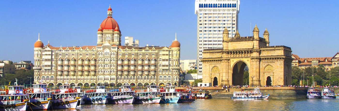
Mumbai History
The name of the city, Mumbai is derived from the deity Goddess Mumba Devi. Mumbai earlier also known as Bombay is the capital of Indian state Maharashtra. It’s situated on the West coast of India between 18˚ 52′ and 19˚ 04′ North latitudes and 72˚47′ and 72˚54′ East longitudes. It is surrounded on three sides by water, the open Arabian Sea to the West, Thane Creek to the east, Vasai Creek to the north, and Mahim causeway is lying on the south side.
Mumbai consists of two distinct regions Mumbai City district and the Mumbai Suburban district. The city district region is also commonly referred to as the Island City or South Mumbai. The total area of Mumbai is 603.4 km2. Mumbai City is 67.79 km2, while the suburban district covers 370 km2, together accounting for 437.71 km2 under the administration of Municipal Corporation of Greater Mumbai (MCGM). The remaining areas are out of the jurisdiction of the MCGM & belong to various Defence establishments, the Mumbai Port Trust, the Atomic Energy Commission, and the Borivali National Park
As per census 2011, Mumbai Urban Agglomeration or Metropolitan region is India’s most populated area & has a population of 1.84 Crore. The Mumbai Metropolitan Region which includes Mumbai City (Greater Mumbai), Thane, Kalyan Dombvali, Navi Mumbai, Mira Bhayandar, Ulhasnagar, Ambarnath & Badlapur covers an area of 1063 km2.
Mumbai - The Early History
Original Mumbai consisted of seven separate islands and formed an outlying portion of the kingdom of Aoaranta or the North Konkan, of which the earliest ruler to history was named Ashoka. To him succeeded a dynasty of Satakarnis or Satavahanas, who flourished about the second century AD, and were in turn succeeded by the Mauryas, Chalukyas, and Rashtrakutas.
The earliest inhabitants of the islands were the Kolis, an aboriginal tribe of husbandmen and fisherfolk who have journeyed thither about the opening of Christian era, and formed rude hut settlements in the portions of the islands which are now known as Upper Colaba, lower Colaba, Dongri, Mazagaon, Naigaon, Sion, Mahim & Warli.
In the Maurya and Chalukya periods ( Ad 450-750) the city of Puri or Elephanta island was the chief place in Mumbai harbor: but under the Shilaharas Chiefs of Konkan (810-1206), Mumbai became better known through the discovery of the Shtigundi or “stone of trial” and the building of Walkeshwar temple at Malabar Point. Some of the oldest edifices in the city built during this period are the Jogeshwari Caves (between 520 and 525), Elephanta Caves (between the 6-7th century), Walkeshwar Temple (10th century), and Banganga Tank (12th century).
But no town sprang up until Raja Bhima, who probably belonged to the house of Yadavas of Deogiri, founded Mahikavati (Mahim) as a direct result of Ala-ud-din Khilji’s raid into the Deccan in 1294. Bhima’s followers, among whom the Prabhus, Palshikar Brahmans, Panchkalshis, Bhandaris, Bhois, and Thakurs were the most noteworthy, spread over the islands and settled in Mahim, Siwri, Naigaon, Matunga, Vadala & Parel.
Mumbai under the Portuguese & British
In 1384 Salsette and Mumbai Isles were conquered by the Sultanate of Gujarat & remained with then until 1534. On 25 October 1535, seven islands of Mumbai came under the control of the Portuguese when Sultan Bahadur ceded them to the Portuguese. The Haji Ali Dargah in Worli, built in honor of the Muslim saint Haji Ali in 1431.
Mumbai remained under the control of the Portuguese till 1734. Thereafter Mumbai Island (Bombay Island) was gifted to the Queen of England in the year about 1760-61. The islands were transferred in 1668 from the crown to the East India Company, who placed it under the factory of Surat. In 1708 East Indian company shifted its headquarters from Surat to Bombay. Bombay Suburban District which is known as Salesette and was the part of Goa which was under the control of Portuguese up to 1771-72, the Britishers took over control of the region of this area. Thus began the journey of the modern city Mumbai.
Mumbai - The Modern City
Mumbai consists of two distinct regions Mumbai City district and the Mumbai Suburban district. The city district region is also commonly referred to as the Island City or South Mumbai. Initially, this island city or city of seven Islands is known as Bombay. During the mid-18th century, Bombay was reshaped by the Hornby Vellard project, which undertook reclamation of the area between the seven islands from the sea. Along with the construction of major roads and railways, the reclamation project, completed in 1845, transformed Bombay into a major seaport on the Arabian Sea. In 1817-18 Bombay became the Capital of Bombay Presidency. In 1838 saw the construction of Colaba Causeway, which united the last of the original seven isles to the main island of Bombay.
In 1871, the Thane district was carved out of the east side of Konkan and Portion of Bombay Island then known as Taluka South Salesette. In the year 1920, the Salesette Taluka was divided into two parts known as South Salesette Taluka and North Salesette Taluka. Basically Salesette taluka consisted of 84 villages which were situated from Bandra to Dahisar and Kurla to Mulund. Thereafter in the year 1920, the Mumbai Suburban District was created consisting of 84 villages of South Salesette Taluka and North Salesette Taluka
During the 19th century, three causeways were made that joined Bombay with the Suburban Districts. The first causeways joined Sion in Bombay with Kurla, Second Mahim to Bandra & third Kurla to Chembur in Trombay. The Population of Bombay city in 1901 is 776,006. Upon India’s independence in 1947 the city was incorporated into Bombay State. In 1960, following the Samyukta Maharashtra Movement, a new state of Maharashtra was created with Bombay as the capital.
